Street Design
Eight different street types (Types A-H) are identified within this guide; their design specifications, main attributes and uses can be found in the ‘Highways Technical Manual’ section of this guide. All street types will contribute to a well-structured network in and relating to settlement areas and can help to accomplish the aim of reducing driving speed. It is generally preferable to use changes in horizontal alignment to restrict drive speed, as physical obstructions like speed humps and chicanes should only be used in those less frequent cases where straight sections of road are required for urban design solutions. In some contexts, such as town centres, a more bespoke approach is appropriate; this should be discussed with the Highway Authority and the Local Planning Authority.
General Design Criteria
The design of new developments should strike an appropriate balance between meeting the needs of all users over their lifetimes and addressing the technical and future maintenance requirements of highways.
Connections between home and other destinations should be as safe and practical as possible, including the incorporation of appropriate resting points. The better and more convenient these are, the more likely that they will be used; developments should identify opportunities to add new or improve existing routes within the Context Appraisal. The improvement of routes to local schools and between neighbourhoods is of primary importance.
Well-designed and landscaped cycle routes, footpaths and other linear features can provide essential links for people of all ages and a range of physical and mental abilities, and can allow wildlife to move safely between habitats. Development can help ensure a connected green infrastructure by undertaking small, incremental interventions and improvements as opportunities arise over time
Streets and roads that are connected in a grid or deformed grid pattern, aid permeability and promote active travel, and there should be a preference to construct networks from linked streets. Cul-de-sac should be limited in number and restricted to those parts of a site which cannot be served in any other way.
The use of cul-de-sac layouts can also deter the elderly, less mobile or those with dementia from engaging in the community. The design lends itself to walking long distances to access services and facilities, which is unattractive to older people and the less mobile, while the presence of dead ends can cause confusion and anxiety for those with dementia. The repeated nature of these layouts, with no clear distinction between areas, can also cause confusion.
While the street types and configurations within the street type table will be adopted by the Highway Authority for the purposes of maintenance, it is open to planning applicants to propose other solutions that achieve the same purposes; these will be considered on their merits.

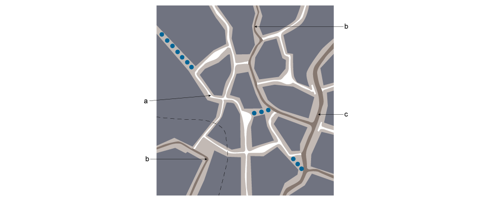
a. 20mph/30kph network. Types E-G
b. Higher capacity feeder road 20mph/30kph. Type D
c. Larger road linking groups of up to 700 dwellings 30mph/50kph. Type B
Mixed-use Streets
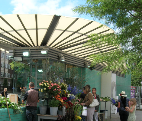
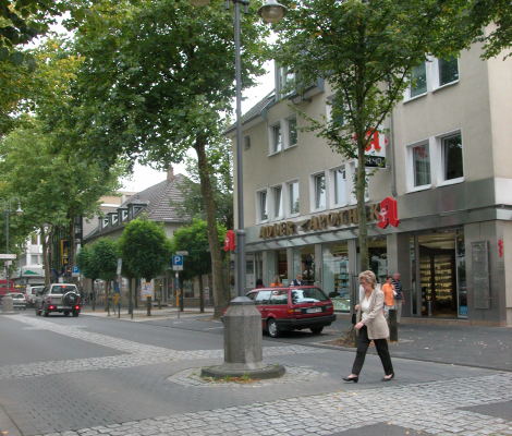
This street type links neighbourhoods in urban areas where commercial or retail use may be mixed with residential use, and where loading access may be required for service vehicles over 7.5 tonnes. This road type may also serve as a local bus route. Mixed-used streets are designed to be the major streets within any urban or neighbourhood centre, but can also be used where the intention is to attract a variety of uses requiring more spacious servicing and access arrangements.
The best quality surface materials are reserved for this type of street. Variations on the standard street type are possible, though differences will should be discussed with the local Highway Authority.
Built frontage will be required along the rear of the footway, but occasional set-backs are permitted where these create small spaces for sitting out. Street trees, lighting columns, parking ticket machines and bus shelters can be incorporated within this zone as integrated features of the street design, taking sight-line constraints into consideration. For dimensions, refer to the Highways table.
Goods and loading provision must be considered at the design stage to ensure that the requirements are dealt with in the most satisfactory way. To accommodate delivery vehicles, laybys for unloading will need to be 2.5m in width, which will have the effect of localised narrowing of the footway. Small delivery vehicles may service units from these on-street loading bays providing that they do not restrict traffic flow. Development proposals should consider the operational requirements of mixed-use units that front the street, and issues relating to deliveries must be discussed and agreed with the Highway Authority.
Rows of street trees should generally be spaced at 17m centres, which should allow for the placement of two single-car parking spaces or one short loading bay between them. Trees should be set back a minimum of 1m from the kerb-line of the carriageway.
Mixed-use streets should be designed to restrain the speed of traffic to 20 mph (30kph) or less. This should be achieved by raised tables at street junctions. Road humps should not be used. Speed-restraint measures are required to be located at least every 60m along the street. As it is desirable that side-junctions will occur approximately every 100m, an interim speed-restraint measure is required between such junctions.
Mixed-use streets may take access from an existing county road of either type 1 or type 2. Junctions require a minimum kerb radius of 10.5m. There must be a minimum straight length from the junction of 22m from the channel of the main road. Sight-lines should be as recommended in Manual for Streets (2007).
Page updated: 19/02/2018

