Technical Design Guidance
Rainwater and stormwater harvesting
Rainwater harvesting is the process of collecting and using rainwater. If designed appropriately the systems can be used to reduce the rates and volumes of runoff.
- Water butts should not be incorporated into site storage calculations due to the efficiency being down to the regular emptying before storm events by the homeowner.
- Primary screening devices used to prevent leaves and debris from entering the tank should be installed to maintain capacity and to prevent blockages.
Soakaways
These are square or circular excavations, filled with aggregate or lined with brickwork, or pre-cast storage structures surrounded by granular backfill.
- If soakaways are the only form of discharge, they should be designed for the 1 in 100-year plus climate change rainfall event as a minimum. If there are alternative outfalls, then soakaways should be designed as minimum for the 1 in 30-year storm event with further storage to be designed to cater for the 1 in 100-year storm event plus climate change.
- The base of the soakaway should be at least 1m from the highest average groundwater level.
- They should be a minimum of 5m away from any foundations and up to 20m if infiltrating into chalk.
- Should be no closer than 6m to an adjacent highway.
- May not be permitted above utilities and services.
Filter strips
These are vegetated strips of land designed to accept overland sheet flow
- Where infiltration is proposed, there should be a minimum of 1 metre between the invert level and the ground water level.
- Slopes should not be exceeding 1 in 20, with a minimum of 1 in 50.
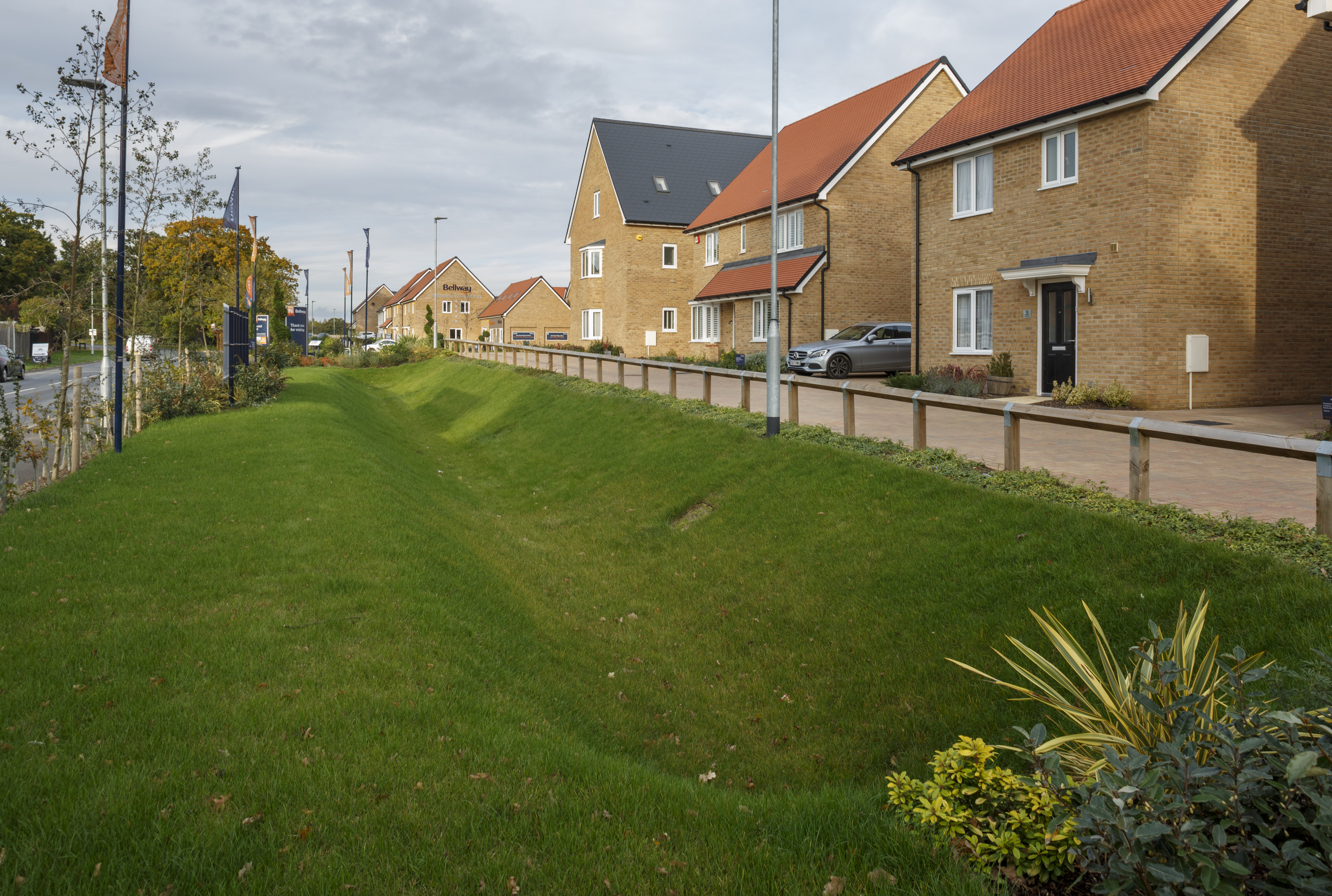
Swales
These are linear vegetated features in which surface water can be stored or conveyed. They can be wet or dry and can be designed to allow infiltration where appropriate.
- Maximum side slopes of 1 in 3, 1 in 4 preferred.
- Check dams and appropriate pre-treatment systems can be used to improve both hydraulic and water quality performance by reducing velocities increasing resistance time and increasing infiltration/storage.
- Natural barriers such as planting can be used to help manage perceived safety risks.
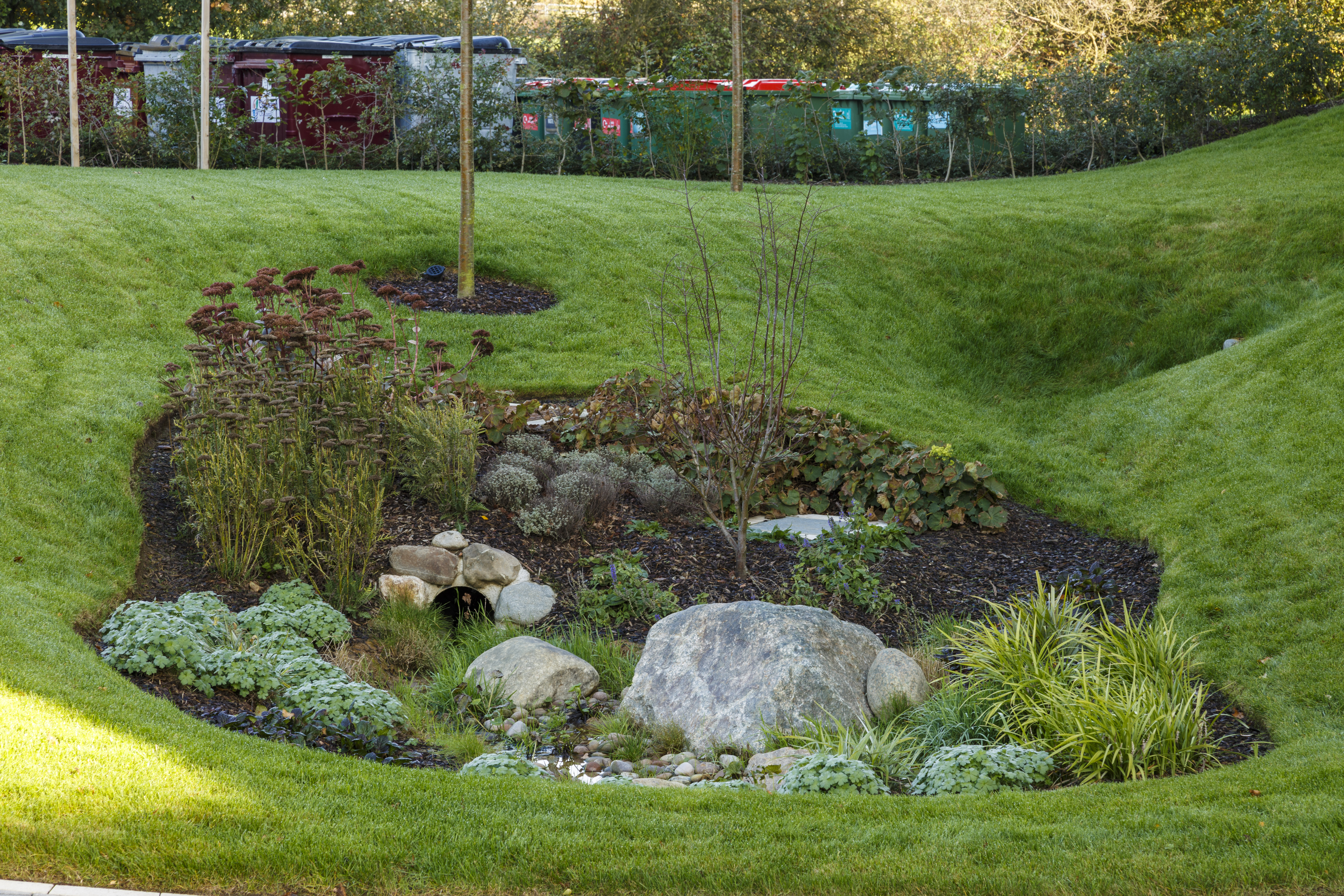
Bioretention areas
These are shallow landscaped depressions or pre-cast units which rely on engineered soil and vegetation to remove pollution and reduce runoff.
- Minimum depth to highest average groundwater of 1m, if unlined
- Should have overflow/bypass facilities for extreme events.
- Maximum recommended area that should drain to a bioretention system is 0.8ha.
Infiltration basins
These are vegetated depressions designed to store runoff and allow infiltration gradually into the ground.
- Maximum side slopes of 1:3.
- Maximum water depth of 1.2m for safety reasons. This can be raised to 2m if sufficient measures have been put in place to reduce any risk. However fencing should be avoided as much as possible to enhance the multifunctional benefits.
- There should have a minimum of a 1m distance between the base and the groundwater level for water quality reasons.
- May not be permitted above utilities and services.
Detention basins
These are surface storage basins that provide attenuation of stormwater runoff and facilitate settling of particulate pollutants. They are normally dry and may also function as a recreational facility.
- Maximum side slopes of 1:3.
- Low flow channels are key in preventing erosion at the inlet and to route last remain run-off to the outlet.
- Maximum water depth of 1.2m for safety reasons. This can be raised to 2m if sufficient measures have been put in place to reduce any risk. However fencing should be avoided as much as possible to enhance the multifunctional benefits.
- May not be permitted above utilities and services.
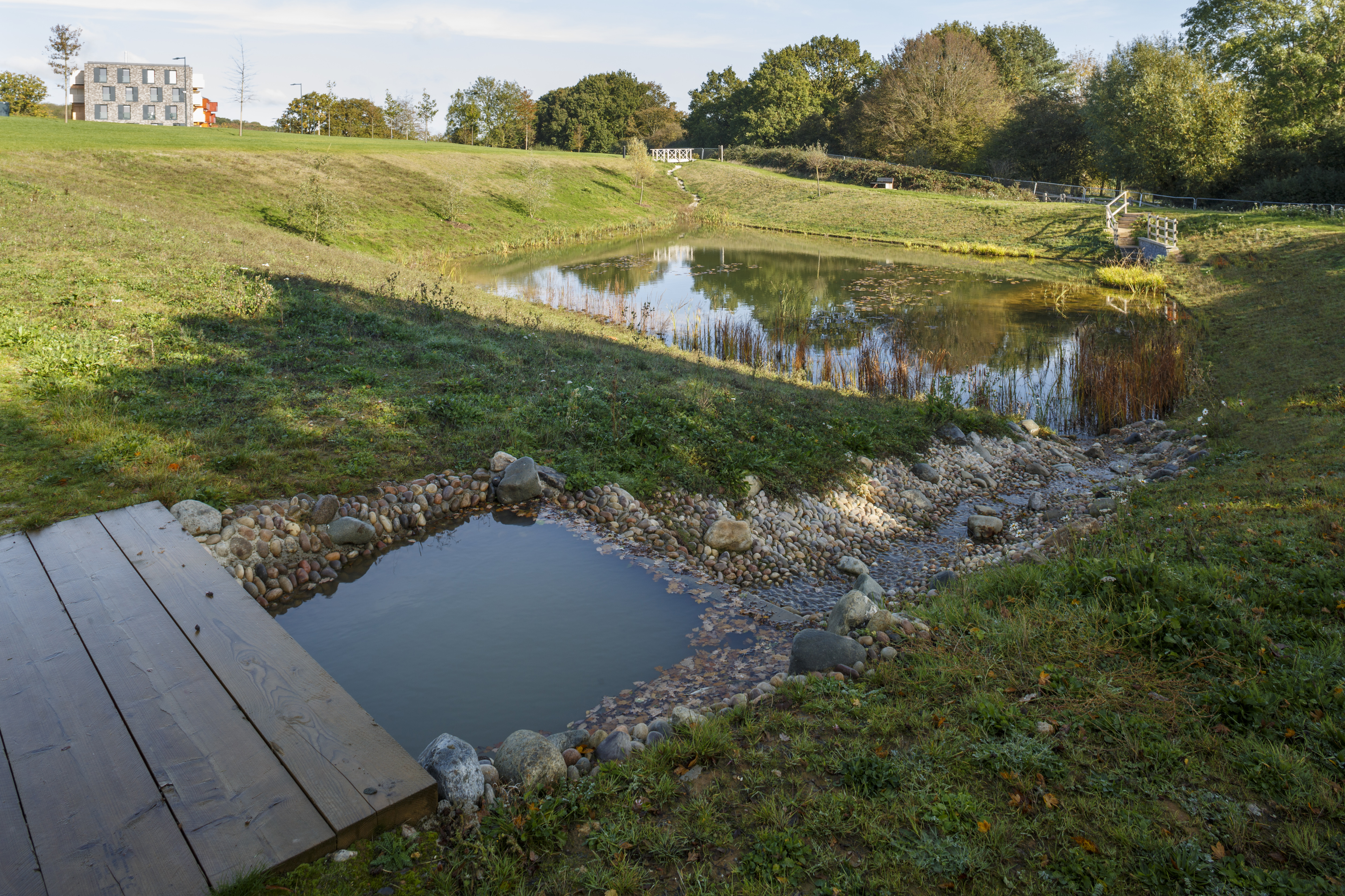
Ponds
These provide for stormwater attenuation and treatment. Permanent pools to support aquatic vegetation and retention time promotes sediment removal.
- Aquatic benches so support planting, acting as a biological filter and providing ecology, amenity and safety benefits.
- Maximum water depth of 1.2m for safety reasons. This can be raised to 2m if sufficient measures have been put in place to reduce any risk. However fencing should be avoided as much as possible to enhance the multifunctional benefits.
- Maximum side slopes of 1:3.
- Consideration should be taken for the overall aesthetic and design of the pond.
Pervious/permeable pavements
Permeable surface allow rainwater to infiltrate through into underlying layer where it is temporarily stored.
- 30% porosity or Type 3 sub-base should be used. Permavoid can be used however this does not provide treatment without the appropriate filtering material.
- Unless unfeasible pervious/permeable pavements should be left unlined to encourage as much infiltration as possible.
- Can be up against buildings (blanket infiltration) as long as there is an impermeable barrier between the two.
Should be constructed towards the end of the construction period to avoid it becoming blocked. If it is constructed earlier, it will have to be sufficiently cleaned and restored back to its original working order.
Page updated: 13/01/2025