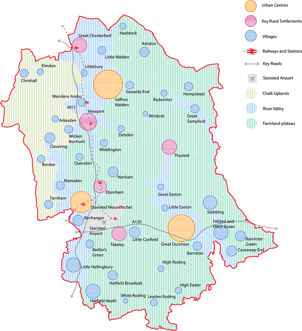
Area Types
The landscape and built environment character of Uttlesford is rich and varied across the district, and new development must respond to this. To aid applicants to form an appropriate design response with new development that responds to the landscape and built environment context, the following area types have been defined, which in turn link to specific character analysis and requirements as set out in the 'Uttlesford Places' section. This is as per Section 2B of the National Model Design Code 'Area Types' and based upon detailed analysis of the existing and historic built environment and landscape character.
Please note the Settlement Hierarchy and Spatial Strategy will be updated in the emerging Local Plan.
The following steps should be followed:
- Applicants should define the 'Landscape Character Area' in which their site is located using the map opposite (for a more detailed map please refer to the Uttlesford Landscape Character Area Assessment 2006)
- Then refer to the relevant analysis and requirements as set out in Section 3.5 Landscape Character and the 'Landscape Identity' requirements
- Applicants should then define the 'Uttlesford Place' which most closely relates to their site, for example, 'Thaxted - Key Rural Settlement' 4. Then refer to the relevant analysis and requirements as set out in that section onwards.
Page updated: 20/07/2023