Landscape Character
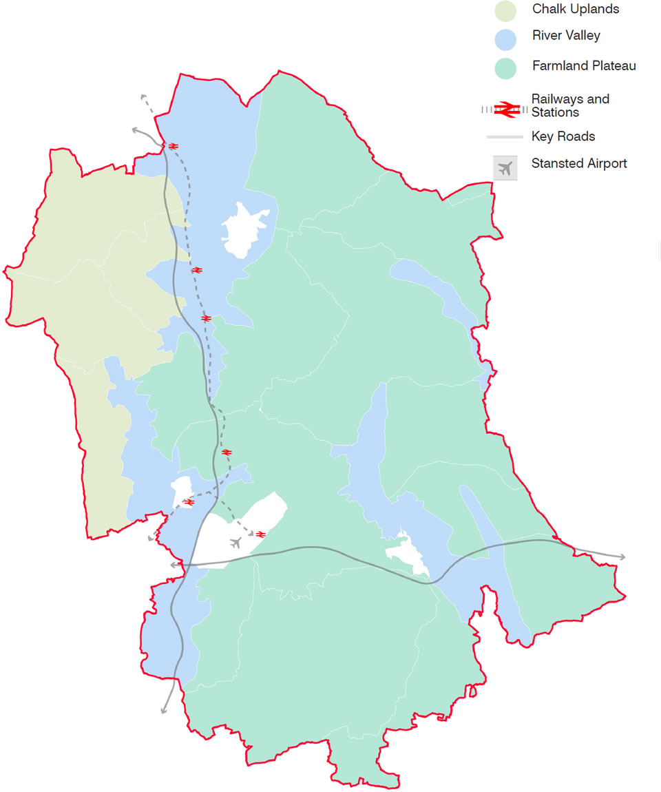
Uttlesford’s picturesque landscapes combine with the built form to create the district’s unique character. This section will explore Uttlesford’s three landscape character areas; Chalk Uplands, River Valley and Farmland Plateau. They each contain a set of distinguishable characteristics that will give the landscape its identity.
The landscape character is defined beyond nature and appearance. It is important to explore the history of the landscape, and how it has developed to serve the area.
The topography and natural features of each profile have influenced their settlement structure, and the built form that sits within them. They also help to frame key views within the district and create important habitats for flora and fauna to thrive.
Landscape character areas
The Design Code should be read in conjunction with the Uttlesford Landscape Character Area Assessment (2006). the identification of landscape character has been carried out in a hierarchical way across Essex and Uttlesford. The National character Assessment identifies geographically character similarities throughout the country. The Landscape Character Assessment for Uttlesford (jointly prepared for Uttlesford, Braintree, Chelmsford, Maldon and Brentwood Councils) maps the Landscape Character Types (LCTs) which share common characteristics but which occure throughout these areas of Essex.
Within Uttlesford three broad landscape character types have been identified. These are further subdivided into 20 sub-character areas. Within this design code the three landscape character areas will be explored at high level however applicants for specific sites should refer to the landscape subcharacter within which they are designing for further guidance.
Preservation of landscape character
By understanding the relationship between buildings and landscape, the contribution buildings and human activity has on the character of the landscape is able to shape how development can continue to maintain the distinctiveness of settlement form and preserve the landscape character across Uttlesford.
Relationship of landscape and settlements
The landscape character overview should be read in conjunction with section 3.6 Settlement Characteristics. Some settlements of a similar form perform a very different function in contributing to landscape character by virtue of their topographical position, which given Uttlesford’s topographical nuances is of importance when creating new settlements or extensions to existing settlements.
For example, a linear settlement may be located along a valley and be hidden by nature of its form. Alternatively, the same linear form located on the top of a hill, or along valley contours creates landmarks within the landscape. The sense of arrival and relationship with the wider landscape is very different between the two positions topographically.
Once an understanding of the form of the settlement and settlement typologies have been made, consideration of the topographical setting should be considered. Consideration should be given to the effect of a variety of topographical factors on the design of a development within any given settlement form.
Understanding variations in landscape form includes identifying differences in micro-climatic conditions. Different landscape forms may present different opportunities to respond to the climate emergency by orientating for maximum solar gain as well as structuring development to create the most walkable development form.
Page updated: 20/07/2023