Nature
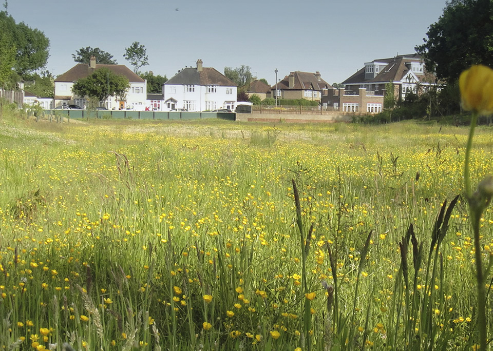
The National Design Guide makes clear that Nature contributes to the quality of place, people’s quality of lives and is a critical component of a well-designed place. Successful and healthy places integrate existing natural assets and incorporate new features to enhance the landscape of their scheme. The below sections of the National Design Guide provide further information on what is expected at a national level:
N1: Provide a network of high quality, green open spaces with a variety of landscapes and activities, including play
N2: Improve and enhance water management
N3: Support rich and varied biodiversity
Nature Expected Outcome N1
Provide a network of high quality, green open spaces with a variety of landscapes and activities, including play
N1.1 Proposals must demonstrate a comprehensive understanding of the existing open space and its function within the area. Thorough analysis will naturally lead to an open space strategy that responds and complements the existing natural assets.
N1.2 The standards set out in Nearby Nature published by Natural England should be adopted for all new developments.
N1.3 Every opportunity to green new urban development from development plot margins to streetscapes and green walls and roofs must be taken so that all new residents or users of developments have daily contact with nature - this can be as simple as seeing house sparrows or butterflies.
N1.4 Multi-functional green infrastructure should be included for example, providing linear rain gardens and integrating SUDS into the open space network.
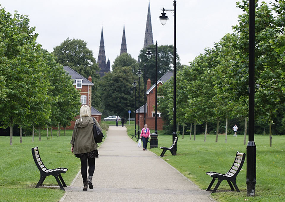
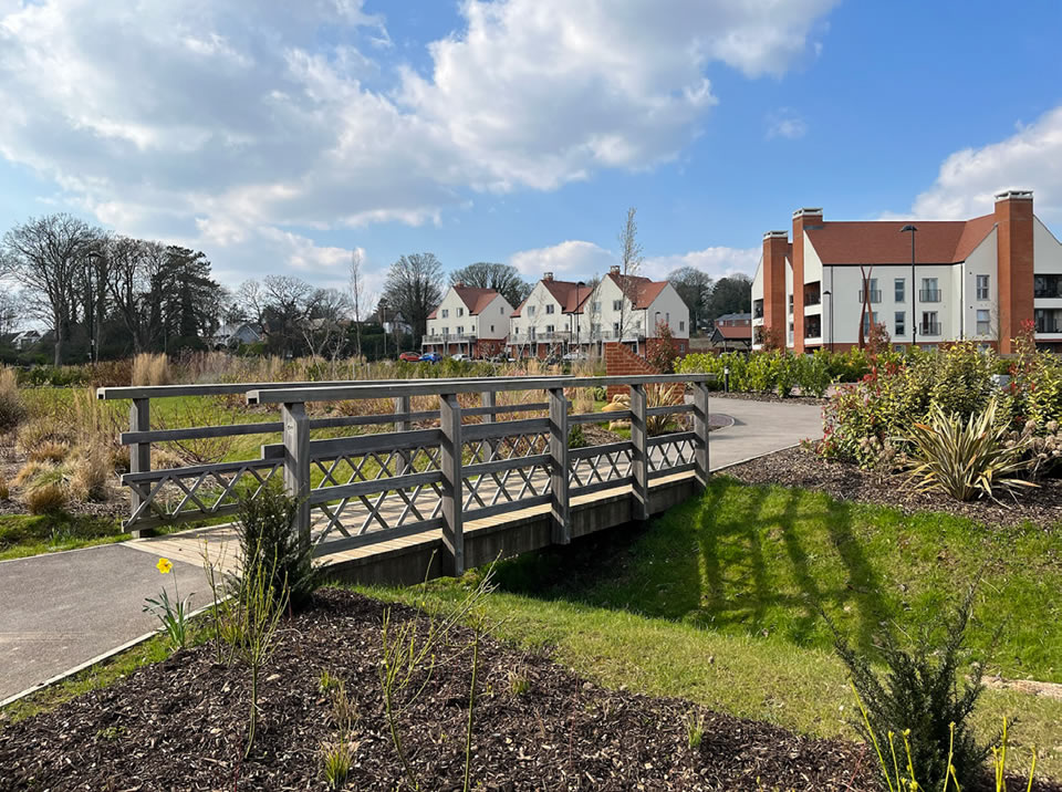
N1.5 Open spaces within the development must be connected and form a wider network via attractive, clear and direct pedestrian cycle routes.
N1.6 Open spaces should be connected via green corridors and the existing green and blue infrastructure network.
N1.7 Open spaces within the development must link via pedestrian and cycle routes with open spaces outside of the development and form part of an area open space network.
N1.8 Where open spaces sit on the edge of the site and border the rural countryside, plans must be submitted outlining how the proposed scheme would access and connect with the adjacent countryside if it was developed.
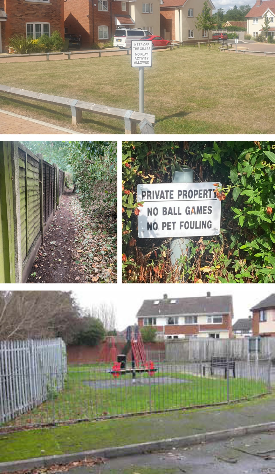
What we don’t want to see
- Over-engineered drainage solutions.
- Open spaces which restrict play such as “no ball games” signs.
- Poorly designed play spaces that aren’t engaging or appealing to potential users.
- Leftover spaces counted towards open space provision.
- Footpaths and Public Rights of Way which are poorly responded to within new developments.
Open Space provision
N1.9 Open space provision should follow the amount specified in the Fields in Trust 2020 guidance or Local Plan policy (when adopted).
N1.10 The minimum required open space will vary depending on the scale of development - see section 5.
N1.12 Landscape buffers should be created where residential development is adjacent to the countryside to create a smooth transition between new development and the rural environment.
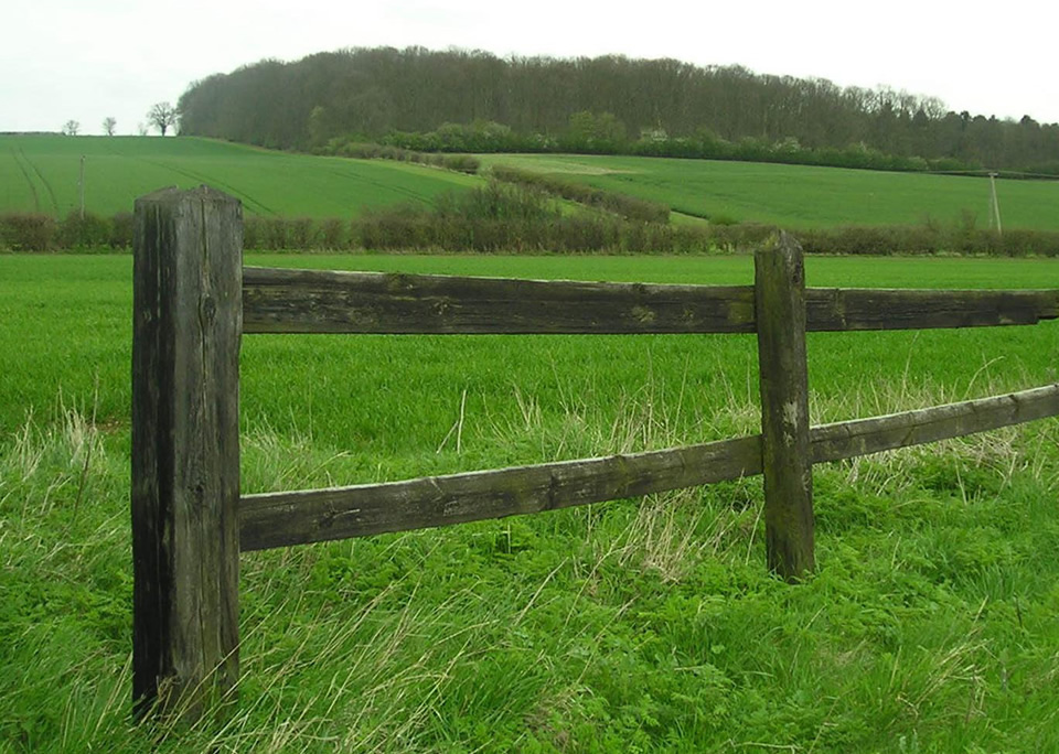
N1.13 Existing natural features such as copses, ditches waterways, public rights of way, hedgerows and other existing landscaping features must be used as the basis for the design of open spaces.
N1.14 Links must be created between new development and the existing network of countryside public rights of way.
N1.15 Space that is required for components such as buffer zones, pumping stations and similar infrastructure must not be counted towards the volume of amenity/green space associated with the scheme.
N1.16 Where sustainable drainage features are counted towards open space provision they must be able to demonstrate multi-functionality across at least 80% of the year.
N1.17 Left-over spaces within proposals will not count towards open space provision. Open spaces must be accompanied by a footpath and demonstrate genuine recreational value.
Open space provision and distance
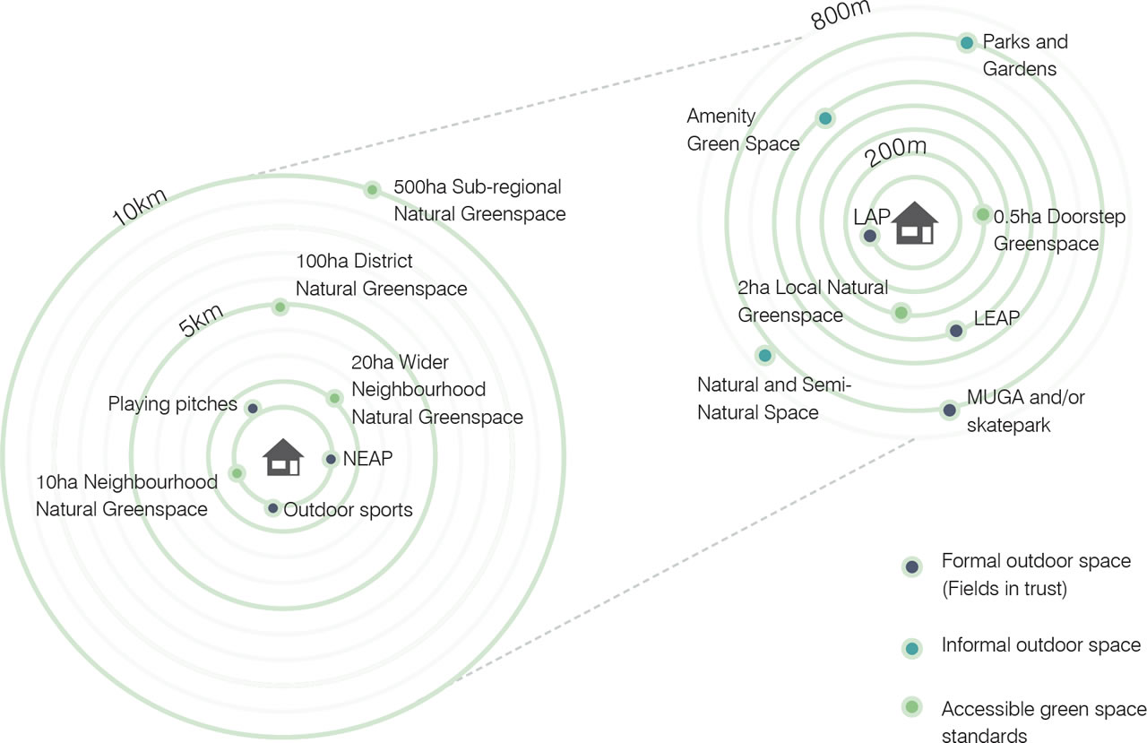
Formal Outdoor Space
| Type | Minimum Size/(per 1,000 population) - hectares | Maximum Distance | Walking time |
|---|---|---|---|
| LAP | 0.01/0.25 | 100m | 1 minutes |
| LEAP | 0.04/0.25 | 400m | 5 minutes |
| MUGA and Skateboard parks | 0.1/0.3 | 700m | 7-10 minutes |
| NEAP | 0.1/0.25 | 1000m | 10-15 minutes |
| Playing pitches and Outdoor Sports | 0.14-1.6/1.2-1.6 | 1200m | 15 minutes |
Informal Outdoor Space
| Type | Minimum Size/(per 1,000 population) - hectares | Maximum Distance | Walking time |
|---|---|---|---|
| Parks and Gardens | 0.6 | 480m | 6 minutes |
| Amenity Green Space | 0.8 | 710m | 8-10 minutes |
| Natural and Semi-natural space | 1.8 | 720m | 8-10 minutes |
Accessible Greenspace Standards
| Type | Minimum Size/(per 1,000 population) - hectares | Maximum Distance | Walking time |
|---|---|---|---|
| Doorstep Greenspace | 0.5 | 200m | 1-5 minutes |
| Local Natural Greenspace | 2 | 300m | 5 minutes |
| Neighbourhood Natural Greenspace | 10 | 1km | 15 minutes |
| Wider Neighbourhood Natural Greenspace | 20 | 2km | 35 minutes |
| District Natural Greenspace | 100 | 5km | 15-20 minutes cycling |
| Sub-regional Natural Greenspace | 500 | 10km | 30-40 minutes cycling |

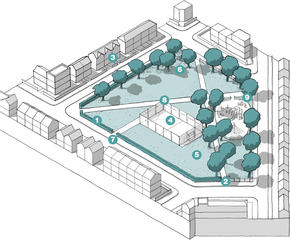
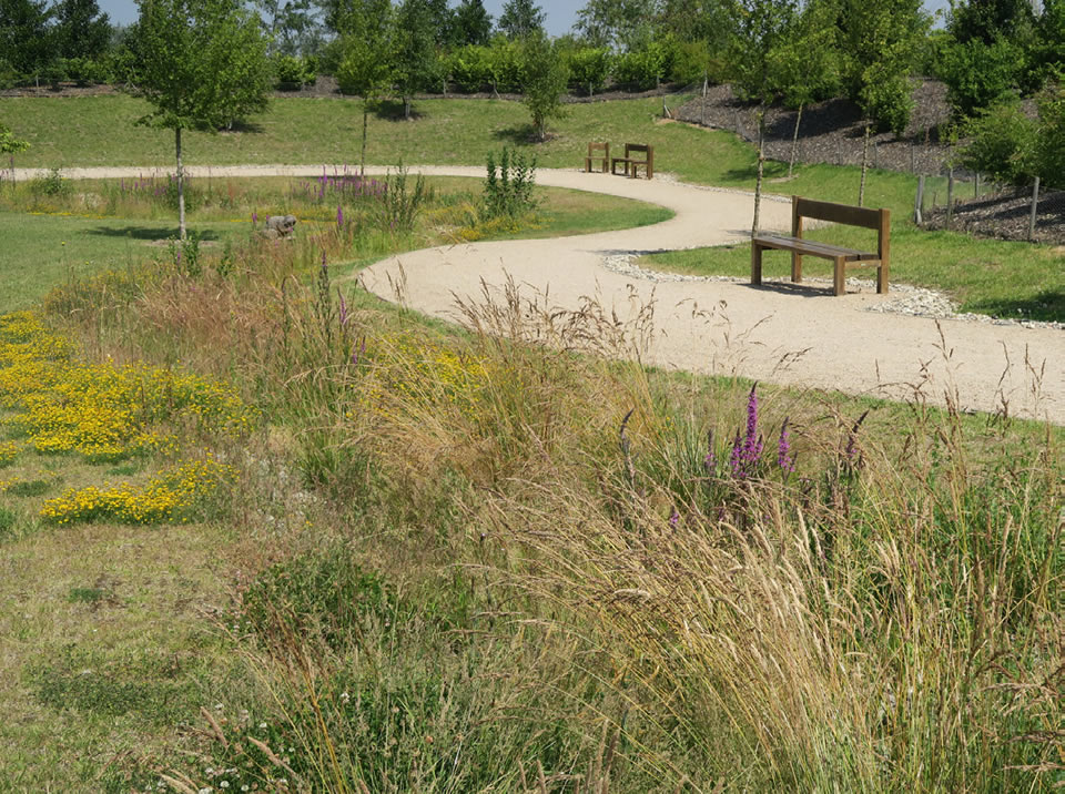
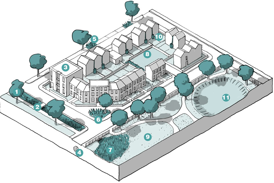
- Open space network: Masterplans should create an interconnected ecological network that encompasses everything from doorstep spaces and private gardens to the surrounding countryside.
- Existing features: Natural assets such as trees, woodlands, hedges, wetland areas and other natural features need to be retained and enhanced where possible.
- Trees and hedgerows: These should be incorporated into public realm and other open spaces as well as private development where appropriate.
Open Space Design
N1.16 Open spaces must have accessible routes for users and clear definition of boundaries to ensure they are secure.
N1.17 Boundary treatments to open spaces must prioritise hedgerows and planting. Proposals incorporating extensive fencing will be resisted.
N1.18 Entrances to open spaces must be obvious and located along the busiest pedestrian routes.
N1.19 Open spaces must be overlooked, with well-lit areas of activity avoiding excessive use of lighting as to cause nuisance to wildlife.
N1.20 Step free entrances to open spaces must be demonstrated and incorporated into designs.
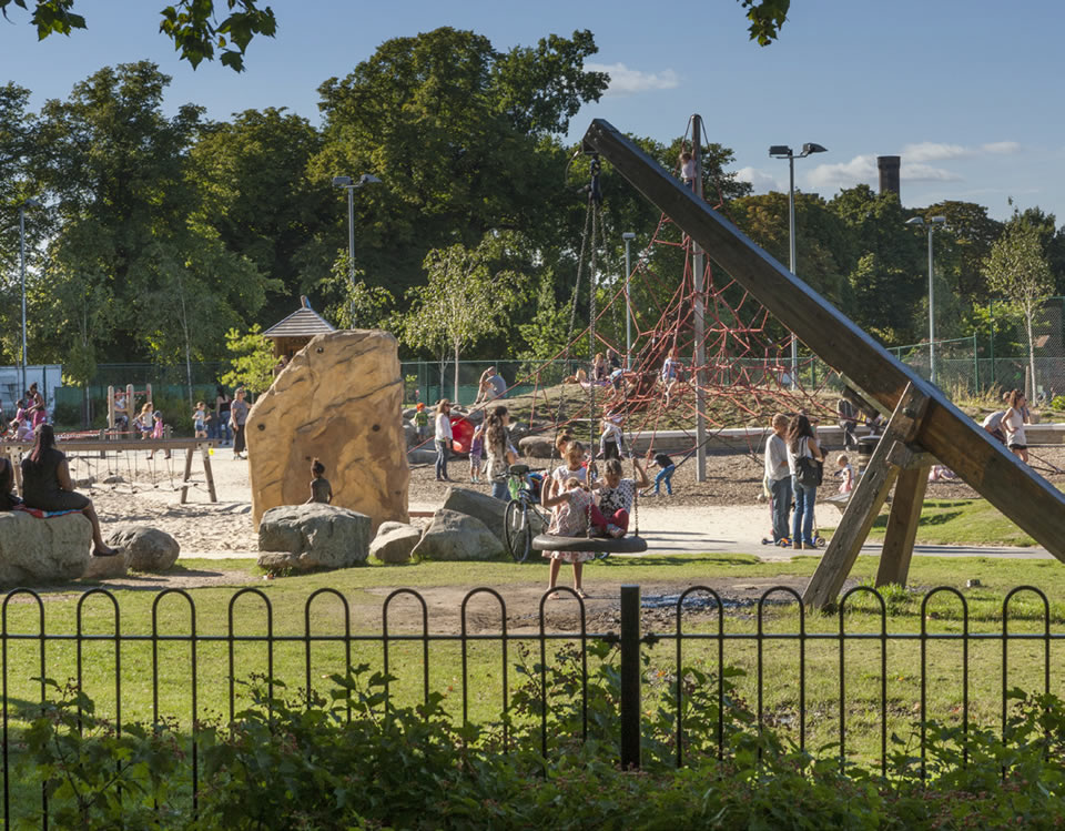
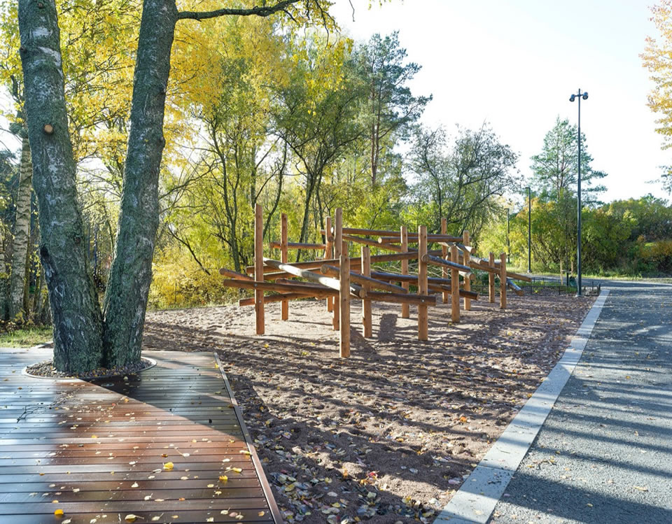
N1.21 Open space should consider a range of infant and adult play.
N1.22 Developments (at the appropriate scale) must include exciting multi-sensory play spaces for children and young people of all ages which are well integrated within the urban realm or the open space network.
N1.23 Play areas should be located within the centre of the development.
N1.24 Developments of more than 100 homes should include one or more of the following: allotments, community growing projects, community orchards in an accessible and appropriate location(s).
N1.25 Schemes should include open spaces that are nature rich areas that contain plants ad species that are native to Uttlesford, or biodiversity rich.
N1.26 Open spaces should have a primary functional role to ensure they do not become unused or neglected.

- Boundary: Consideration needs to be given to whether the space is fenced and gated without interrupting wildlife networks.
- Entrances: Access points and paths need to be conveniently located on desire lines for walking and cycling.
- Surveillance: Open spaces need to be overseen from surrounding buildings, streets and public spaces.
- Activity: Sufficient space needs to be provided for sports pitches and play areas to avoid conflict with other uses.
- Maintenance: The design of the space needs to take account of maintenance and adoption requirements.
- Ecology: Green spaces need to include areas that are nature-rich.
- Access: Public open space needs to be accessible and welcoming to everyone.
- Lighting: Needs to be considered for well-used footpaths and games areas but should avoid light spillage that causes nuisance and harms wildlife.
- Allotments and community growing: need to consider community growing projects for food production, learning and community engagement.

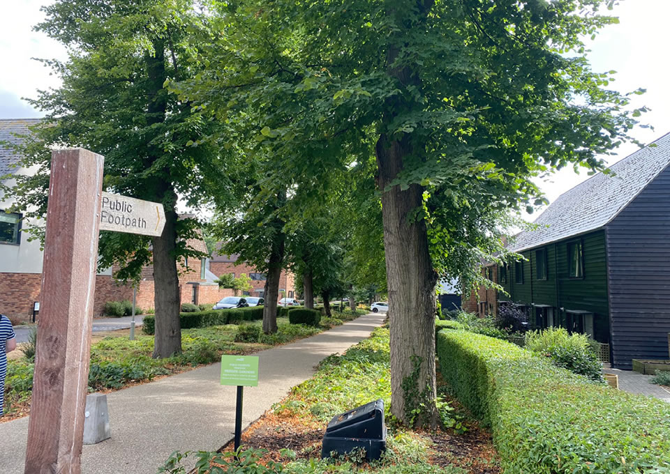
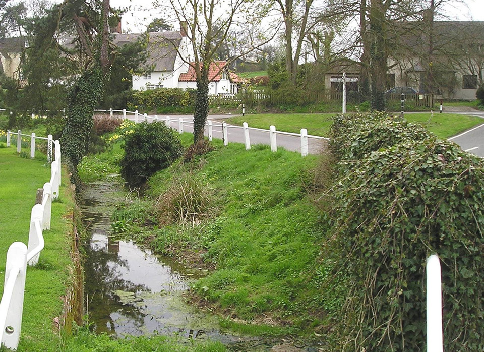
Public Rights of Way
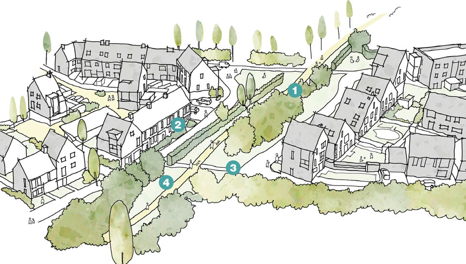
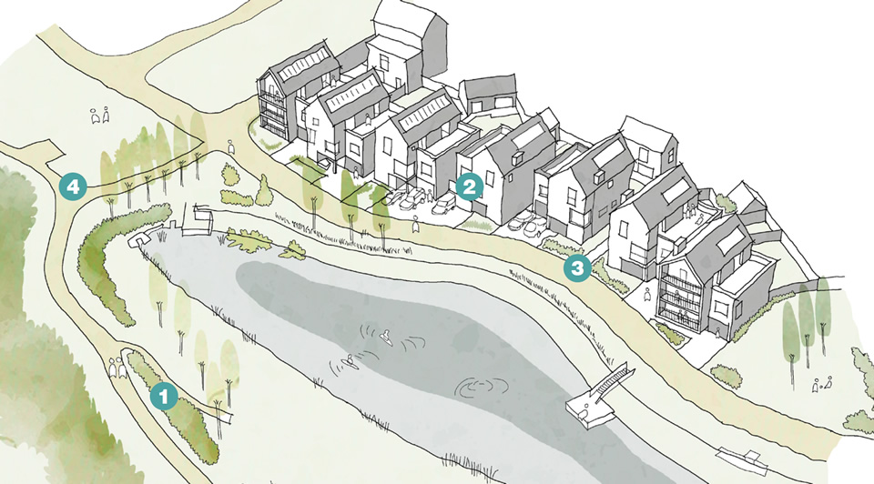
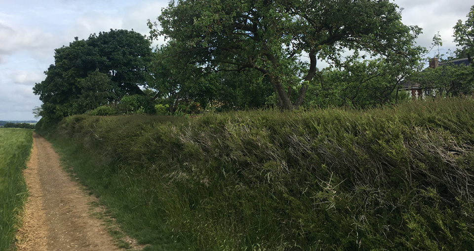
- Existing hedgerows and trees are retained alongside the Public Right of Way to maintain the natural character for walkers.
- Homes overlook the green corridor enhancing surveillance and activity.
- Regular permeability is provided from within the residential area to the footpath.
- The footpath forms part of a wider green infrastructure network providing access connectivity for people and nature and enhancing health and well-being.
- Private gardens “back” onto the surrounding landscape and footpath.
- Natural, low boundaries enable a safe and attractive walking route.
- Footpaths from private gardens provides a sense of activity and passive surveillance.
- Landscape buffer is sufficient to create a useable recreational function.
- Spaces to rest are incorporated along the route.
- Permeability is provided from the residential area, connecting open spaces.
Nature Expected Outcome N2
Improve and enhance water management
N2.1 Proposals must evidence an understanding of existing water management constraints and opportunities before improving and designing new water management.
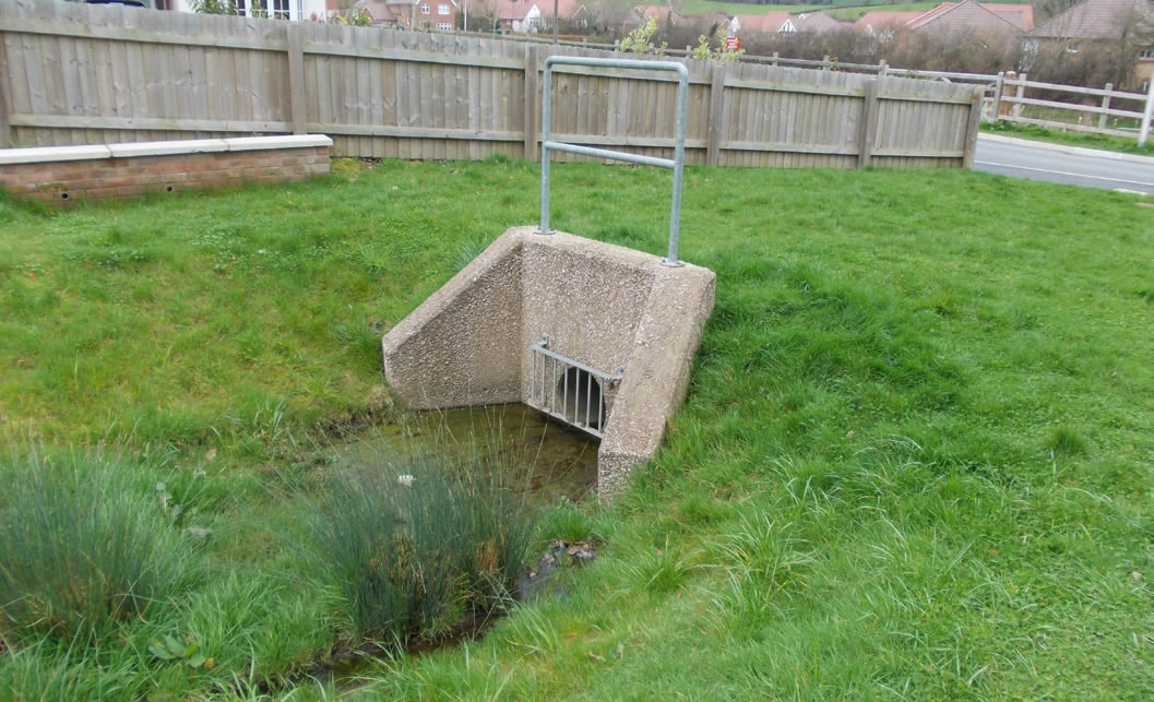
N2.2 Retention and attenuation basins must not take the character of unnatural engineered depressions or include unattractive components within their design.
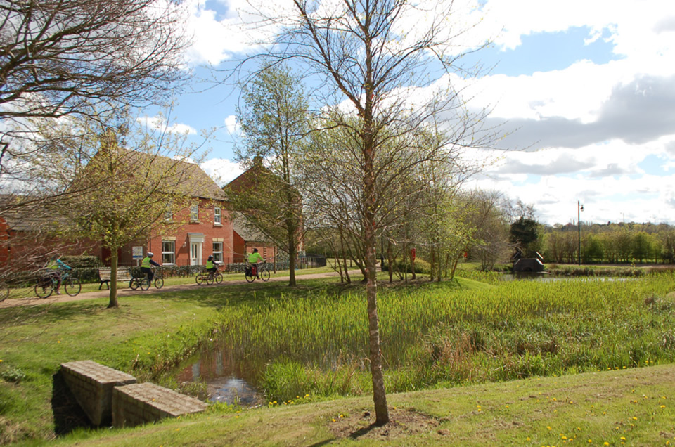
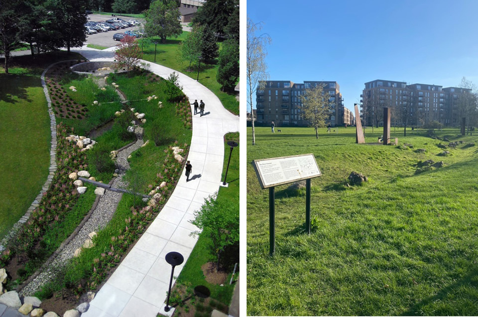
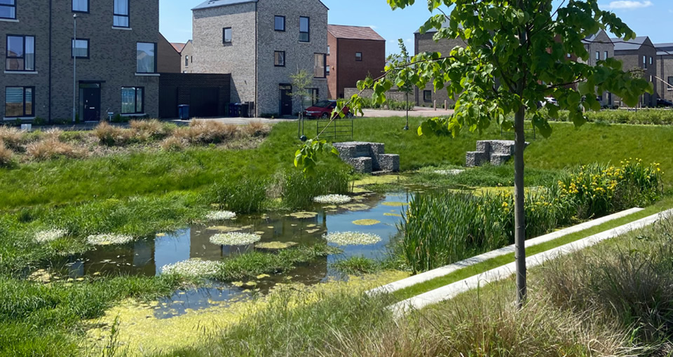
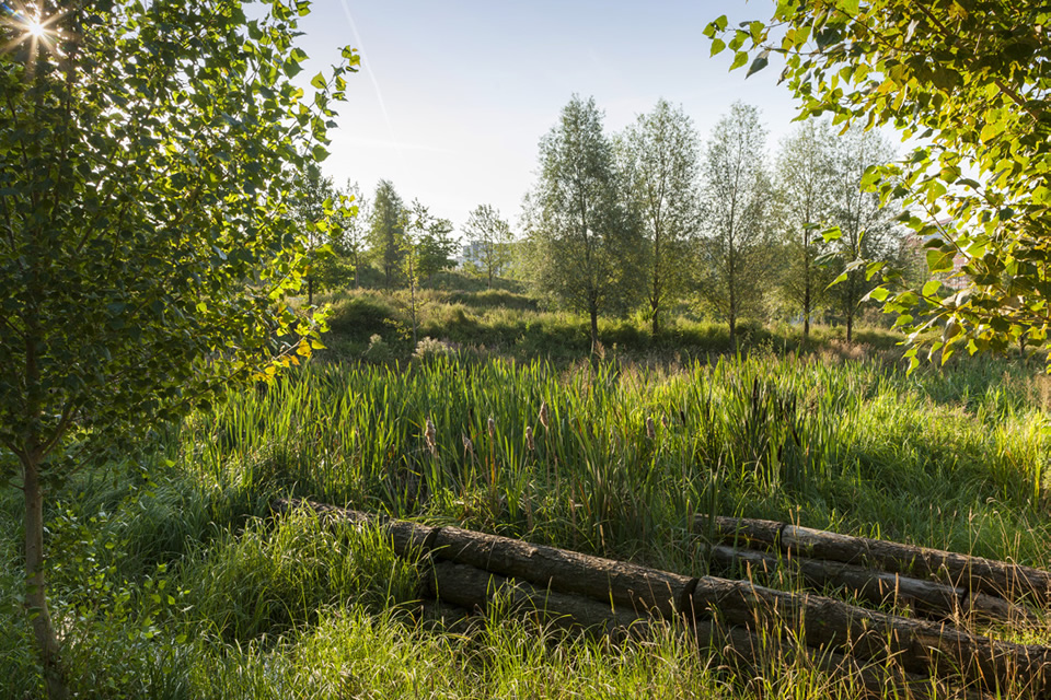
N2.3 Water should be incorporated into green infrastructure design, for example rain gardens, swales and ponds with pond deck seating.
N2.4 Some surface water should be captured for reuse to help with the sustainable management and long-term maintenance of green infrastructure features within the scheme.
N2.5 Where included, volumes of water should be split across the site and have wider positive impacts on water management.
Flood Risk
N2.6 A flood-risk assessment and drainage strategy must be prepared early in the design process and proposals must demonstrate how this has been considered within designs.
N2.7 New developments must be able to demonstrate that their resilience under existing and future extreme rainfall events predicted under 2050 climate models.
N2.8 Measures to reduce flood risk such as planting more woodland should be explored.
N2.9 Street and tree planting should be used as one of the primary means of storm and surface water management and supplemented with more traditional drainage infrastructure where necessary.
N2.10 Permeable paving should be used in site designs to slow water runoff.
Sustainable Drainage
N2.11 Sustainable Drainage Systems (SuDS) must be designed in accordance with the nationally described hierarchy of drainage and the most recent edition of CIRIA SuDS manual and DEFRA’s technical standards on SuDS.
N2.12 SuDS must reflect the form and appearance of planted natural watercourses rather than artificial basins.
N2.13 SuDS measures should be designed at or near the surface and located with discharge routes following the SuDS hierarchy.
N2.14 New sustainable drainage measures must look to include human scale multi-functionality within their design such as play features and increased biodiversity.
N2.15 SuDS and soft landscape maintenance plans are co-beneficial in order to minimise both current and future risk of SuDS failing due to lack of maintenance.
What we don’t want to see
- Existing watercourses being culverted or diverted.
- Over-engineered solutions with steep sides which do not integrate into the wider public realm.
- Below ground surface water storage where above ground features such as ponds or swales are practical offering benefit to people and wildlife.
- Unsympathetically designed structure such as standard headwalls without landscaping or poor quality boundaries.
- Street trees
- Swales
- Green roofs
- Retention tanks
- Soakaways and filter drains
- Rain gardens
- Reedbeds and wetlands
- Permeable surfacing
- Connection of nature to wider surroundings
- Rain capture (water butts)
- Basins and ponds
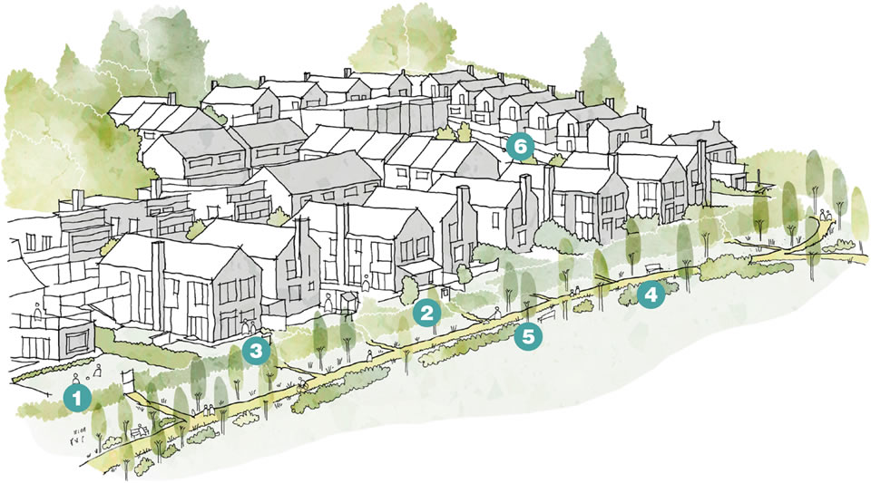
Multi-functional SuDS
- Existing hedgerows and trees are retained alongside the Public Right of Way to maintain the natural character for walkers.
- Homes overlook the green corridor enhancing surveillance and activity.
- Regular permeability is provided from within the residential area to the footpath.
- The footpath forms part of a wider green infrastructure network providing access connectivity for people and nature and enhancing health and well-being.
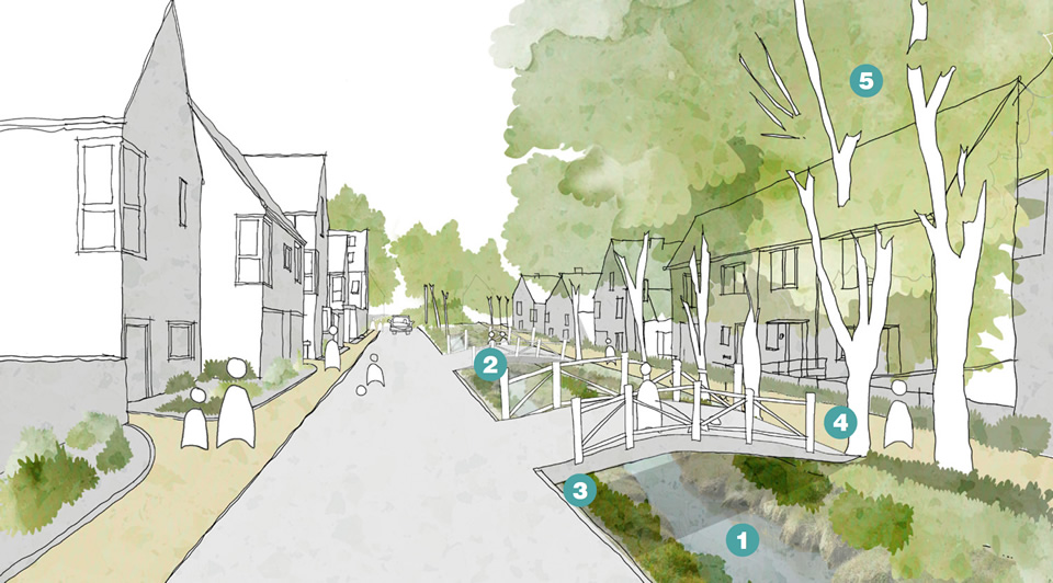
- A swale is the backbone of the scheme emphasising the importance of the multi-functional SuDS.
- Bridges over the swale provides permeability and access for residents.
- The swale is lined with biodiverse planting and native species.
- Footpaths are integrated into the design of the swale providing an opportunity to exercise amongst nature.
- Large mature trees provide additional interception for rainfall.
Nature Expected Outcome N3
Support rich and varied biodiversity
N3.1 Any development in Uttlesford must deliver minimum 10% biodiversity net gain in accordance with national net gain legislation, using the latest version of the Defra calculator.
N3.2 Developments of 100+ homes are expected to be ambitious in delivery of net gain and to showcase exceptional examples of ecological mitigation and enhancement. These developments (see section 5 Development Scale Coding) are expected to deliver 20% biodiversity net gain.
N3.3 Applicants must provide a baseline assessment to demonstrate an understanding of the scheme’s biodiversity opportunities and constraints.
N3.4 Proposals must follow the mitigation hierarchy approach to biodiversity net gain, starting with: ‘avoid, minimise, restore and offset’.
N3.5 Net gain delivery should follow a spatial hierarchy, with the maximum number of credits possible to be delivered onsite. This is followed, in decreasing order of preference, by offsite compensation within Uttlesford and as close as possible to the development, and then offsite compensation within Essex. Compensation elsewhere is considered to be a last resort.
N3.6 Loss of higher distinctiveness habitats must not be offset by provision of larger areas of lower distinctiveness habitats, or by habitats of a different broad habitat type, even if this delivers an overall net gain in numbers of units.
N3.7 Schemes in areas identified in the Essex LNRS and Living Landscapes should outline their compliance with the area’s habitat creation priorities by, for instance, creating new parcels of target habitats or boosting connectivity among existing parcels onsite and/or offsite.
N3.8 Proposals that positively contribute to the habitat network by creating linking sites will be viewed favourably, especially if it contributes to the Essex Wildlife Trust Living Landscape initiative.

N3.9 Habitat creation for net gain should be Hedgerows responsive to landscape configuration, so that it can contribute to existing ecological networks and create new networks and green corridors.
N3.10 Opportunities to connect multiple habitat patches (on-site or offsite) by creation of similar or complementary habitat should be embraced. This is especially important for areas of national Priority Habitats and/or Priority Habitats within Essex BAP.
N3.11 Schemes within “corridors” identified within the Living Landscapes should demonstrate their contribution landscape ecological connectivity.
N3.12 Landscaping schemes should seek to maximise the contiguity and size of areas managed for biodiversity, following ecological theory and the principles of “bigger-better-more joined up” set out originally in the Lawton review.
N3.13 In appropriate settings such as within existing urban areas, opportunities to “green” buildings with features such as green roofs and living roofs should be taken.
Hedgerows
N3.14 All developments must meet the 10% minimum national requirements for hedgerow provision. Use of native hedgerows as boundaries is preferred over walls or fences.
N3.15 Schemes must conserve and enhance existing hedgerows and restore where possible with hawthorn where gappy and depleted to emphasize the existing landscape character.
N3.16 Hedgerows specified as boundaries in developments should contain a minimum of five native woody species.
N3.17 Hedgerows in public green space within developments should be managed for conservation following guidance (such as The Wildlife Trusts, 2023).
Ancient Woodlands
N3.18 Where development sites incorporate or border parcels of ancient woodland, these irreplaceable habitats must be retained in line with government standing advice.
N3.19 All developments should retain a minimum buffer zone of 15 metres around ancient woodlands, comprising created or retained seminatural habitats.
N3.20 Ornamental non-native planting, amenity lawns, residential gardens, drainage features and semi-planted landscape typologies such as grasscrete must not be included within these buffer zones.
N3.21 Paths may be included where this will encourage pedestrians to keep to a specified route and minimise trampling of the created habitats; these should use a no-dig specification to avoid root damage to trees.
N3.22 Planting in buffer zones will be expected to provide vegetation which buffers the edges of ancient woodland from impacts of altered microclimatic conditions, artificial light spill, polluted run-off and informal human access.
N3.23 Greater buffer widths may be necessary in the case of larger impacts, such as elevated levels of air pollution.

Designated Sites
N3.24 Where development sites incorporate or border designated sites (Essex Local Wildlife Sites, Local Nature Reserves and Sites of Special Scientific Interest), landscape design will be expected to follow buffer requirements as per ancient woodlands.
N3.25 Planting within designated sites will be expected to demonstrate how designs respond to the habitats presented at the designated site, as are typically set out within the relevant citation information.
N3.26 Opportunities to extend the habitats present within the designated site and enhance ecological networks should be taken.
N3.27 Where development sites incorporate or border rivers and streams, landscape design will be expected to follow buffer requirements as per ancient woodlands.
N3.28 Buffer zones are required to design out impacts on protected species such as water vole or otter (both of which are protected Essex Priority species), safeguard aquatic habitats and incorporate these habitats into the wider network of habitats within green spaces.
N3.29 Proposals that result in the loss or deterioration of irreplaceable habitats such as ancient woodland will be refused.

Protected Species Mitigation and Enhancements
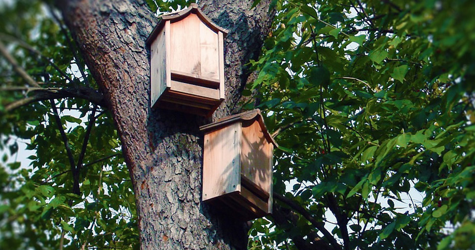
N3.30 At least one out of every three homes within residential developments will be expected to be fitted with bat boxes.
N3.31 Bat boxes should be of the integrated “bat brick” type and clustered on buildings, with at least two boxes fitted per building.
N3.32 Bat boxes should be sited in the most suitable aspects.
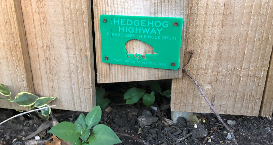
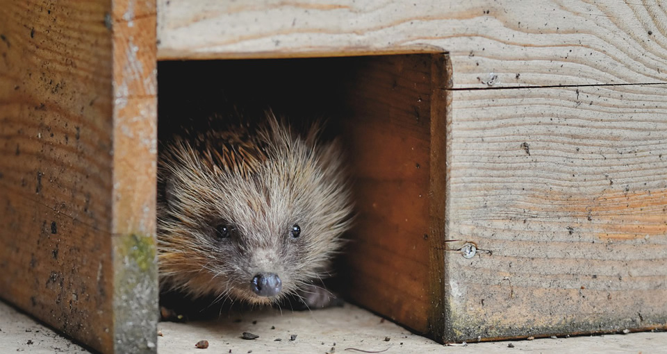
N3.33 Developments must seek to maintain connectivity across residential parcels for hedgehogs and other small animals.
N3.34 All residential gardens with enclosing fences or walls must incorporate hedgehog holes (15x15 cm gaps or tunnels under walls or fences) positioned to connect the focal garden with at least two other gardens (i.e. a minimum of two holes).
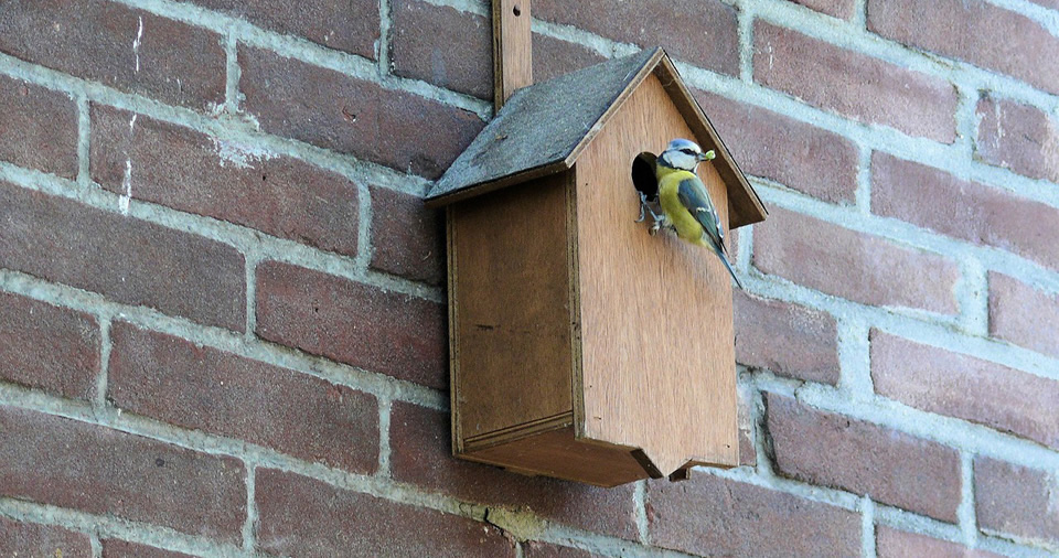
N3.35 Bird boxes must be incorporated into at least one in three homes. These should be targeted to Priority of nationally declining species that use urban environments and nest boxes, specifically swift, house sparrow and starling.
N3.36 All nest boxes added to homes must be integrated and sited appropriately as below:
- Boxes for house sparrow and starling should be placed on aspects between north and east between 2-4m and should be clustered in groups of at least two
- Boxes for sparrow should be sited close to retained or created areas of dense vegetation
- Swift bricks should be sited in accordance with guidance from Swift Conservation (2022)
Nature and Uttlesford’s Landscape Character
N3.37 Proposals must ensure that new habitat creation is designed to enhance landscape character and contribute to nature recovery and that species composition reflects local character.
N3.38 Schemes must conserve and manage field boundaries, and strengthen where necessary through planting native species appropriate to local landscape character.
N3.39 Schemes must conserve and enhance existing hedgerows and restore where possible with hawthorn where gappy and depleted to emphasize the existing landscape character.
N3.40 Development should seek to conserve restore marginal riverside habitat such as marshland and pasture, reed beds and off-stream wetlands.
N3.41 Where proposals re-use farm buildings they must ensure they protect habitats for key species such as bats, barn owl and barn swallow.
Chalk uplands
N3.42 Development should manage existing shelterbelts and restock to encourage young tree growth.
N3.43 Proposals must retain, enhance and connect species-rich grassland and verges on thin chalk soils to promote biodiversity and deliver nature recovery.
N3.44 Footpath routes must be enhanced with carefully sited woodlands at selected locations to frame views and enhance biodiversity.
N3.45 In areas of chalk upland, schemes should plant and site carefully new mixed woodlands and shelterbelts to enclose vast tracts of farmland and emphasise landform and protect and enhance existing biodiversity assets.
N3.46 Landscape character should be enhanced by planting new beech hangers on carefully sited knolls, hill-tops and scarps to form focal points to reinforce local chalklands landscape where these do not result in the loss of valuable grassland habitats.
Farmland Plateau
N3.47 Development must conserve and manage the ecological structure of woodland, copses and hedges within the character area.
N3.48 Proposals must establish arable field margins as important nature conservation habitats.
N3.49 Proposals must conserve and manage wet meadows within the floodplain.
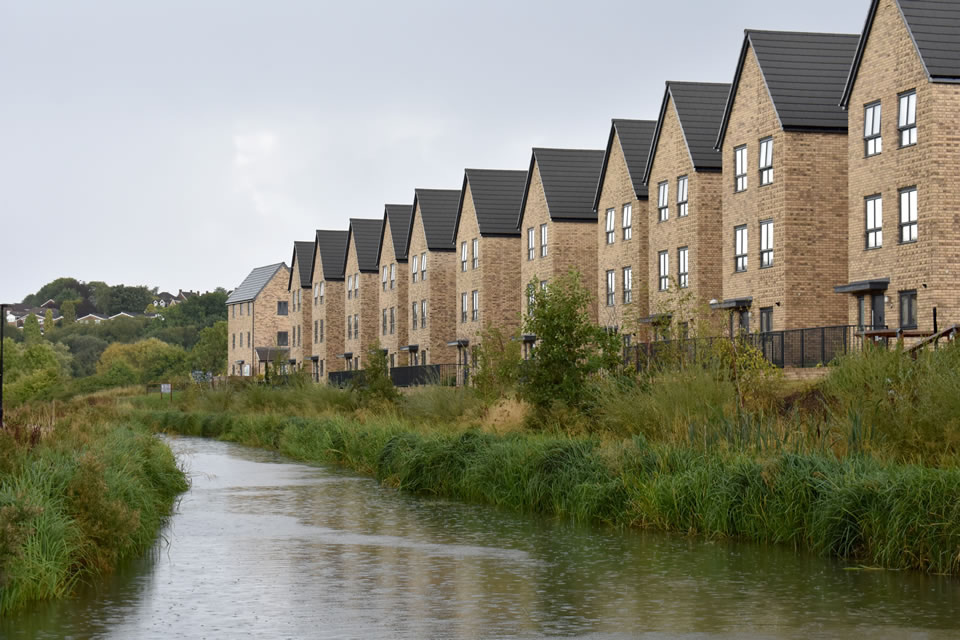
River Valley
N3.50 Development must manage ensure that new riverside planting and other habitat creation is designed to enhance landscape character and that species composition reflects local character.
N3.51 Proposals must protect and enhance the role of the river valley as a key element of the nature recovery strategy in providing a network of informal open space and nature conservation sites.
N3.52 Schemes must conserve and enhance the green ‘natural’ character of the river valley through appropriate management, restoration and creation of wildlife habitats.
Page updated: 20/07/2023