Settlement Characteristics
Settlements of all periods are often fluid entities, being created and disappearing, expanding and contracting, and sometimes gradually shifting. In some cases that is in response to particular circumstances, and in others to longer-term trends whether social, economic or even climatic.
In Uttlesford, a number of patterns emerge when analysing the structure of its many settlements. For many places in the district, history, landscape, and trade, has had a pivotal role in shaping how the village has evolved. For others, modern development and community has shaped the settlement in a certain way.
This section will explore, identify and summarise some of Uttlesford’s key settlement characteristics, including their structure, focal points, and their interaction with natural and historic assets.
How we’ve characterised settlements
The District’s settlement is generally a mixture of villages, hamlets and dispersed farmsteads; many of the latter clustered around commons and greens particularly on the clay plateaux. Farmsteads characteristically lie at intervals along the winding lanes, each set within its own group of fields. There is also a recurrent pairing of medieval churches and manorial halls, usually in prime valley-side locations close to a water supply.
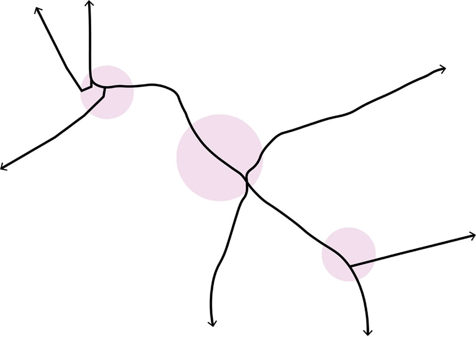
Relatively large, irregular, places are said to be ‘agglomerated’, while settlements which comprise clusters of houses strung together (sometimes with suffixes like ‘End’, as in Duck End, or Parva [Little] and Magna [Great]) are termed polyfocal villages. Very few settlements are clearly one settlement type or another; most comprise features of different categories, but there are some overall common arrangements as set out in the following pages.
Polyfocal Linear Structure
Polyfocal settlements typically originated from properties strung out along an extensive network of linear and triangular greens. (The smallest greens, often under five acres, tend to be the triangular ones associated with crossroads where three roads meet). Many of these linear greens and ‘ends’ have a number of moats and farmsteads dispersed along them, e.g. Berden, Henham, Felsted area.
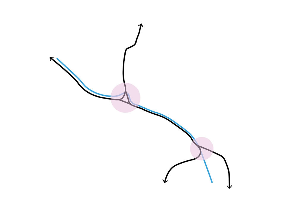
Linear Structure
Linear settlements often originated historically from ribbon development along Roman (or earlier) roads or trackways such as Stane Street (the original Roman road from Braughing to Colchester) or that between Harlow and Cambridge. The Roman occupation saw the establishment of strategic forts, and small towns developed along existing and new routes where there may already have been some earlier small scale settlement.
Linear settlements also developed along heaths (e.g. Hatfield Heath) and along linear greens or sometimes other landscape features as well as other later thoroughfares, such as in the Great Dunmow area.
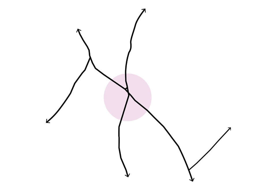
Nucleated Structure
Nucleated settlements tended to develop from a clear focus such as a crossing point on a river, or a hall/church complex, sometimes a castle, or a road junction. Development then radiates out along the routes that often converge at or near the focus of the settlement, e.g. Hadstock.
The principal manorial sites and the parsonages are frequently near the church in the core of their parishes, but the minor (smaller) manors and former free tenements are often in a peripheral position and similar in appearance, i.e. moated.
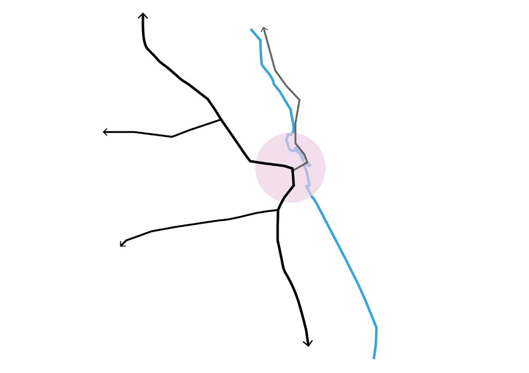
Focal linear structure
These often originated as nucleated settlements along a thoroughfare with later ribbon development spreading from the focal point along the route, creating a more linear structure.
Stansted Mountfitchet and Great Dunmow are both examples of this type; Stansted with a centre next to the castle and linear settlement along the former Roman road, whilst Dunmow’s centre is focussed around the Church with linear development along the High Street.
Development in Open Countryside
Uttlesford is recognisable for the relationships between landscape and small scale developments which fall outside the settlements and villages. Buildings for may be residential, agricultural or other community uses however are typically small ribbon developments, farmstead clusters or manor houses / isolated buildings. These typologies are referenced in section Uttlesford’s Built Character.
Page updated: 20/07/2023